Stanley Park Seawall guide
The Ultimate Stanley Park E-Bike Tour
How long is the Stanley Park Seawall?
The full loop around Stanley Park is 8.8 kilometres, a flat paved path suited to walking, cycling, or e-biking. Walking the full loop takes roughly 2 to 2.5 hours; cycling it takes 45 minutes to an hour at an easy pace.
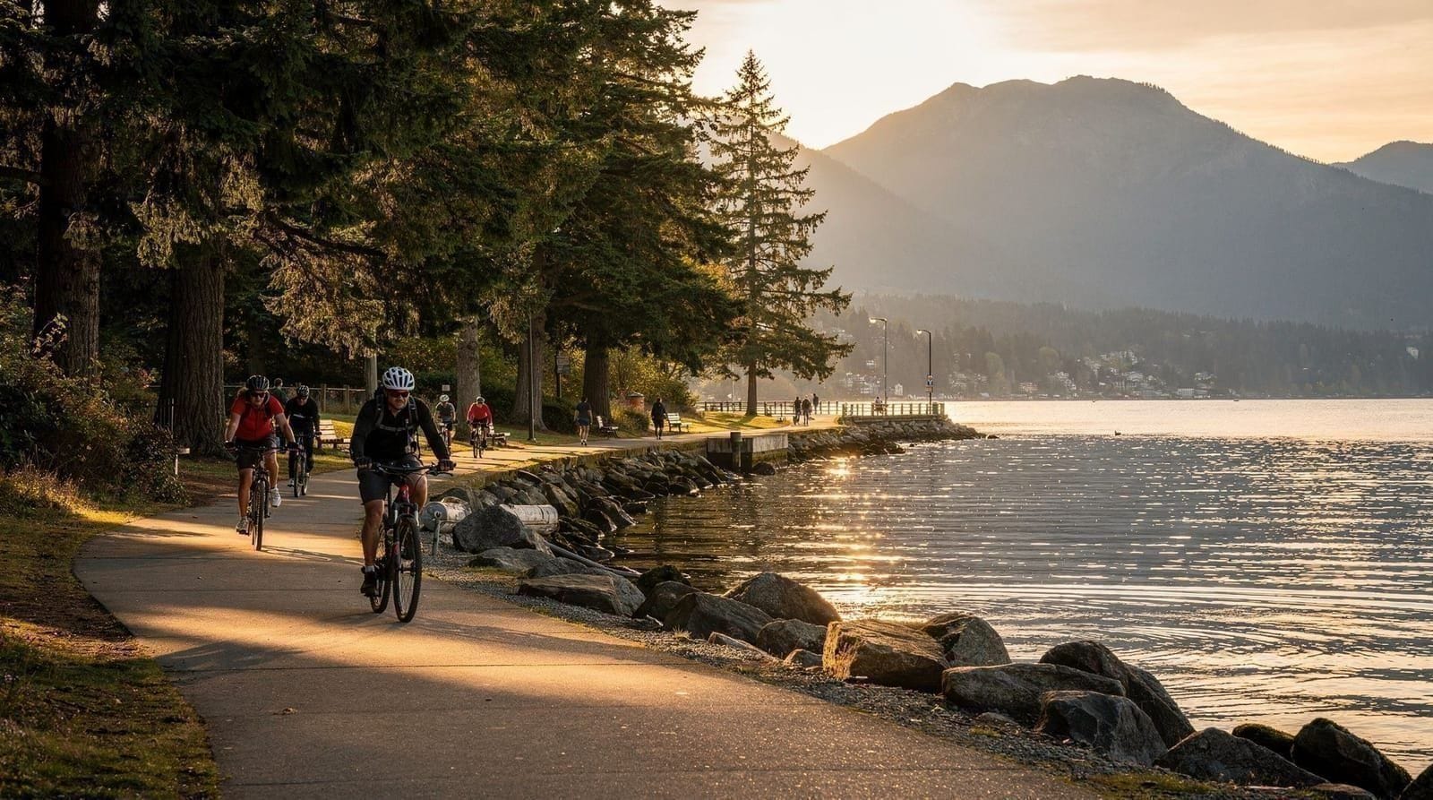
Stanley Park sits on a peninsula jutting into Burrard Inlet right at the edge of downtown Vancouver, and the seawall that traces its entire perimeter is arguably the single most-used piece of recreational infrastructure in the city. It’s a flat, paved, 8.8-kilometre path with water on one side for virtually its whole length — no other major North American park has quite this combination of scale, accessibility, and unbroken waterfront.
| Distance | 8.8km full loop |
| Time needed | 2–2.5hrs walking; 45min–1hr cycling |
| Cost | Free; bike rental around CAD 10–15/hr |
| Direction | Counter-clockwise only for cyclists |
| Best time | Weekday mornings or early runs, 6–8am |
The basics of the loop
The seawall forms a complete loop around Stanley Park’s outer edge, starting and ending near the park’s entrance close to Coal Harbour and Denman Street. It’s entirely flat, paved, and separated for most of its length between a pedestrian path and a dedicated cycling lane, which matters because the two user groups move at very different speeds and the park enforces separation for a reason — collisions between fast cyclists and pedestrians drifting into the bike lane are a recurring, avoidable problem.
Total distance for the full loop is 8.8 kilometres, and there’s no shortcut through the middle of the park that follows seawall infrastructure — cutting the loop short means leaving the seawall itself and walking or biking through the park’s interior trails instead.
The seawall was built in stages over more than half a century, largely under the direction of a single master stonemason, and the continuity of that construction is part of why the surface and low retaining wall feel consistent across the entire loop despite the decades separating different sections.
Walking vs cycling vs e-biking
On foot, the full loop takes roughly 2 to 2.5 hours at a comfortable, unhurried pace, longer with stops for photos or beach time. It’s an easy walk with zero elevation change, suitable for most fitness levels, though 8.8 km is still a real distance and not something to underestimate on a hot day without water.
By bicycle, the same loop takes 45 minutes to an hour at an easy pace, faster for anyone riding with purpose rather than sightseeing. Cycling is the more popular way to do the full loop precisely because it makes the distance manageable within an hour rather than requiring a half-day commitment.
E-bikes have become an increasingly common way to cover the loop, particularly for visitors who want the scenery without the physical effort of a standard bicycle, or who want to combine the seawall with additional riding elsewhere in the city on the same rental. A guided Stanley Park e-bike tour covers the full loop with a guide narrating stops along the way, useful for visitors who’d rather not navigate independently or manage bike logistics themselves. It’s also a practical option for visitors who want to see the whole park but are working with limited time or limited fitness for a full walking loop.
One-way traffic for cyclists
Cyclists on the seawall move counter-clockwise only — this is an enforced rule, not a suggestion, and applies for the park’s entire cycling lane length. It exists because the lane is narrow in sections and two-way bike traffic at typical seawall speeds would be genuinely dangerous given how many riders use the path simultaneously on a summer weekend.
Pedestrians can walk in either direction on their separate path, but cyclists riding against the flow are a real hazard to others and are the most common source of seawall collisions. Rental shops on Denman Street brief riders on this before handing over a bike, but visitors bringing their own bike or arriving via bike share should confirm the direction before setting off, since getting it wrong midway through the loop means either turning back or continuing against traffic.
Key stops along the route
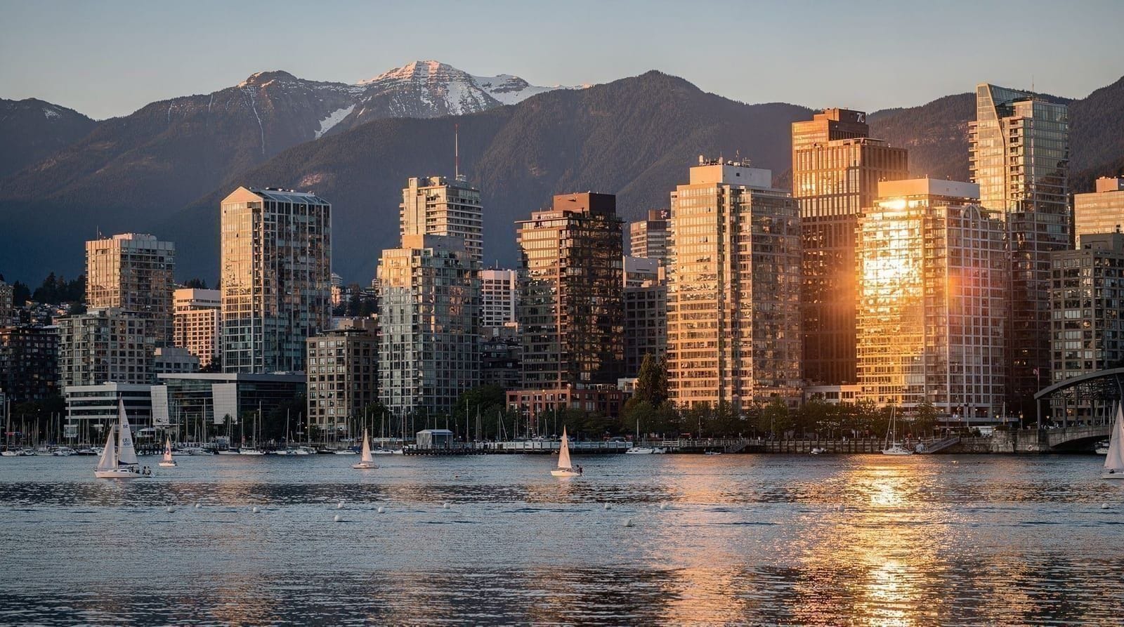
Starting from the Denman Street entrance and heading counter-clockwise, the route passes several landmarks worth knowing in advance rather than discovering mid-ride. Coal Harbour and the marina give way to Brockton Point and its totem pole display, one of the most-photographed stops on the loop. Continuing around the north side, the path passes beneath the Lions Gate Bridge, with clear views up at the underside of the span and across to the North Shore mountains. Prospect Point, the park’s highest seawall-accessible viewpoint, offers a wide outlook over the First Narrows and the bridge from above rather than below.
Further along the western side, Siwash Rock — a distinctive sea stack just offshore, tied to local Indigenous legend — marks the approach to the park’s more exposed, oceanfront stretch facing the open waters of English Bay. From there the route passes Third Beach and then Second Beach, both genuine swimming and sunbathing beaches rather than viewpoints only, before the seawall curves back toward the park’s southern entrance near English Bay Beach and downtown.
Where to stop for food and rest
Unlike a wilderness trail, the seawall has several practical rest points built into the route. The area near the aquarium and Brockton Point has washrooms and small concession stands; Third Beach and Second Beach both have snack bars in season and picnic areas set back from the path itself. Prospect Point has a restaurant and lookout with seating, a reasonable spot to break up a walking loop roughly two-thirds of the way around. Denman Street at the start and end of the loop has the widest range of actual restaurants, making it a sensible place to bookend the ride or walk with a proper meal rather than relying on park concessions.
Bike rentals near the entrance
Denman Street, just outside the park’s main entrance, has a concentration of bike rental shops offering everything from basic city bikes to e-bikes, typically priced somewhere in the range of CAD 10 to 15 per hour or CAD 30 to 40 for a half day, varying by shop and bike type. Renting here rather than elsewhere in the city makes sense simply for proximity — it’s a short roll from the rental shop directly onto the seawall path.
For visitors who’d rather not compare shops or negotiate rental terms independently, a guided Stanley Park bicycle tour includes the bike as part of the booking, along with a guide who can point out the landmarks worth stopping for rather than riding past them.
Self-guided options
Not every visitor wants a live guide narrating the route, and for those who’d still like context on what they’re passing, a self-guided smartphone audio tour provides commentary triggered by location as visitors walk or cycle the loop at their own pace, without the fixed schedule of a group tour. It’s a reasonable middle option for visitors who want more context than a map provides but don’t want to coordinate their pace with a group.
Accessibility
The seawall’s flat, paved surface makes it one of the more accessible outdoor routes in Vancouver for wheelchair users, strollers, and anyone who finds uneven trail surfaces difficult. There are no stairs on the main loop itself, and rest points with benches appear at reasonably frequent intervals along the route. The main friction points are crowding on the pedestrian side during peak summer weekends, and the sheer distance of the full loop for anyone with limited stamina — sticking to a partial section rather than attempting the full 8.8 km is a reasonable adjustment rather than a compromise.
Realistic time budgets
For a walking visit covering the full loop with reasonable stops for photos and a beach break, budget 3 hours total. For cycling, 1.5 to 2 hours covers the loop plus stops comfortably. Visitors with less time can walk or ride a partial section rather than the full loop — the stretch from Denman Street to Prospect Point via Brockton Point and under the Lions Gate Bridge covers most of the route’s best-known landmarks in under half the total distance, a reasonable option for anyone with under an hour to spare.
The seawall connects directly to the rest of Stanley Park’s interior, including forest trails, the aquarium, and other attractions, so a seawall loop pairs naturally with additional time spent inside the park rather than standing alone as the only activity. Visitors based in downtown Vancouver can walk to the park entrance directly, making the seawall one of the easiest half-day activities to add to a city-based itinerary without arranging transport.
A longer history of the seawall
Construction on the seawall began in 1917 and continued in stages for over 60 years, not reaching full completion around the park’s entire perimeter until 1980. For much of that construction period, one stonemason in particular is credited with building large sections of the wall by hand, a detail Vancouver Parks still references in the seawall’s official history.
That drawn-out timeline is part of why the wall’s construction and materials look visually consistent despite spanning six decades — later sections were deliberately built to match the earlier stonework rather than adopting whatever techniques were fashionable at the time of construction. The completed seawall is often cited as the longest uninterrupted waterfront path in the world, a claim tied specifically to its unbroken loop around the entire park perimeter rather than any single record-length stretch.
What else is in Stanley Park beyond the seawall
The seawall is the park’s best-known feature, but it’s the perimeter of a much larger park interior that includes old-growth and second-growth forest trails, a public aquarium, formal rose and rhododendron gardens, and the totem pole displays at Brockton Point, which represent multiple First Nations and were installed and expanded over decades starting in the 1920s.
Visitors with only enough time for the seawall loop will miss all of this, which is worth knowing if the seawall is being treated as “doing Stanley Park” rather than one piece of a larger park that rewards more time. For visitors continuing on to other parts of the city afterward, Gastown and Granville Island are both a short trip from the park’s downtown-facing entrance and make reasonable next stops on the same day.
Comparing to North Shore attractions
Visitors deciding how to split limited time between the seawall and the North Shore’s paid attractions should treat them as genuinely different kinds of outings rather than competing options. Capilano Suspension Bridge and Grouse Mountain both require a drive or transit connection across the Lions Gate Bridge or Second Narrows, while the seawall is walkable from most downtown hotels. A common, workable pattern is the seawall on a morning without a car, paired with a North Shore excursion — Capilano, Lynn Canyon, or Grouse — on a separate day when transport to the North Shore has already been arranged.
Weather and seasonal notes
The seawall is usable year-round, being flat and paved with no seasonal closures, though the experience shifts considerably with weather. Summer brings the busiest crowds, particularly on weekends, with cyclists, walkers, joggers, and rollerbladers all sharing the path at once. Fall and spring are quieter and often more comfortable for cycling, with cooler temperatures and thinner crowds.
Winter sees the fewest users and occasional wet, windy conditions on the exposed western stretch near Siwash Rock and Third Beach, where wind off English Bay can be sharp even when downtown feels calm. Rain doesn’t close the seawall, but a wet paved surface changes braking distance and traction meaningfully for cyclists, worth keeping in mind on drizzly Vancouver days, which are common outside summer.
How it compares to a North Shore day out
Visitors trying to decide whether a Vancouver trip should prioritize the seawall or a North Shore excursion to somewhere like Lynn Canyon or Grouse Mountain are, in practice, comparing two different categories of experience rather than competing options for the same afternoon. The seawall delivers classic, easily accessible urban-waterfront Vancouver — flat, fast to reach, no real physical demand. A North Shore outing delivers genuine forest or alpine terrain a short drive away. Neither substitutes for the other, and most multi-day itineraries have room for both without much conflict.
Second Beach pool and other stops worth knowing
Beyond the landmarks already mentioned, Second Beach has an outdoor, heated saltwater swimming pool open through the summer months, a popular stop for families that isn’t obvious from the seawall path itself unless specifically sought out. The park’s formal rose garden and the Vancouver Aquarium both sit just off the seawall near the Brockton Point area, easy detours for anyone willing to step away from the water briefly. None of these require leaving the park or adding meaningful time to a seawall visit, but they’re easy to miss entirely if the goal is simply completing the loop without pausing.
Combining with other downtown attractions
Because the seawall starts right at the edge of downtown, it pairs easily with other central Vancouver stops on the same day without needing a car. Gastown, with its historic architecture and shops, sits a short walk from the park’s southeastern entrance, while Granville Island is a quick trip by mini-ferry across False Creek from roughly the same area. Visitors planning a full downtown day sometimes start with the seawall in the cooler morning hours, then shift to these more urban stops in the afternoon once the walking or cycling is done.
Wildlife along the route
The seawall passes close enough to the water for regular marine wildlife sightings without any special effort — harbour seals hauled out on rocks near Siwash Rock and the western shoreline are a common sight, and sea lions occasionally appear in the waters near the Lions Gate Bridge, particularly in fall and winter when herring runs draw them into the inlet. Bald eagles nest within the park and are visible year-round, most reliably near the taller trees along the park’s interior edges rather than directly over the water. None of this requires detouring from the main path — it’s incidental to walking or cycling the loop rather than a dedicated wildlife-watching activity, but worth watching for particularly on quieter, early-morning laps.
Running and jogging the seawall
Beyond walking and cycling, the seawall is also one of the most popular running routes in the city, with a dedicated pedestrian lane wide enough to accommodate runners moving faster than typical foot traffic without constant weaving. Early morning, roughly 6 to 8am, is when the running crowd is heaviest and the tourist crowd is thinnest, an overlap that makes it a genuinely pleasant window for anyone wanting to combine exercise with sightseeing before the day gets busy. The full loop at an easy running pace takes 45 minutes to an hour, similar to a relaxed cycling pace, and several shorter out-and-back options exist for runners not aiming to complete the entire 8.8 km.
Where the seawall fits in a wider Vancouver trip
For visitors weighing the seawall against North Shore hiking options, it’s worth noting the seawall requires essentially no fitness or elevation gain, unlike trails covered in the best hikes near Vancouver roundup — it’s a fundamentally different kind of outdoor activity, closer to a scenic walk than a hike.
For a comparable flat, easy walking option away from Stanley Park’s crowds, Pacific Spirit Park offers a quieter, forested alternative on the city’s west side, though without the seawall’s continuous water views. Between the two, the seawall is the better choice for anyone wanting classic Vancouver views — mountains, harbour, Lions Gate Bridge — in a single accessible loop, while Pacific Spirit Park suits visitors who’ve already done the seawall and want a genuinely quiet forest walk instead.
Frequently asked questions about Stanley Park Seawall guide
Can I skip part of the seawall if I’m short on time?
Yes — the stretch from Denman Street to Prospect Point via Brockton Point and under the Lions Gate Bridge covers most of the best-known landmarks in under half the full 8.8km distance, a reasonable option for under an hour to spare.
Is the seawall accessible for wheelchairs and strollers?
Yes, the entire loop is flat and paved with no stairs, making it one of the more accessible outdoor routes in Vancouver; the main friction points are crowding on weekends and the sheer distance for anyone with limited stamina.
Top experiences
Bookable activities with verified prices and instant confirmation on GetYourGuide.