Pacific Spirit Regional Park guide
Vancouver: Botanical Gardens Tour and Museum of Anthropology
Is there a bookable tour for Pacific Spirit Park?
No — Pacific Spirit Park is a free public regional park with no admission and no dedicated bookable tour. It is best visited independently, on foot, by bike, or paired informally with a UBC campus visit.
Pacific Spirit Regional Park is the forest most Vancouver visitors never see, mostly because it doesn’t have a headline attraction — no suspension bridge, no gondola, no bear enclosure, and no single postcard viewpoint that dominates its marketing the way other North Shore and city parks tend to have. What it has instead is roughly 73 km of interconnected trails through second-growth coastal forest, wrapped around the UBC (University of British Columbia) peninsula, used far more by local dog walkers, trail runners, and students cutting between campus and the beach than by out-of-town tourists ticking off a sightseeing list. If you want a genuine, quiet forest walk without leaving the city or crossing to the North Shore, this is it.
| Where | UBC peninsula, western edge of Vancouver |
| Cost | Free, no admission gate |
| Time needed | 45 minutes for a short loop; half a day with a beach descent |
| Getting there | 20–25 min by car, or bus routes 99, 4, 14, 44 from downtown |
| Best time | Year-round; driest and easiest June–September |
Where it is and how to get there
The park sits on the western edge of the city, bordering the UBC campus, roughly 20–25 minutes from downtown Vancouver by car via 4th Avenue or 16th Avenue, traffic-dependent. By transit, several TransLink bus routes that serve UBC (the 99 B-Line, 4, 14, and 44 among others, depending on your starting point downtown) run along or near the park’s edges, making it genuinely accessible without a car — a contrast to most of the North Shore’s rainforest walks, which are harder to reach by transit.
There’s no single main entrance the way a ticketed attraction would have one. Instead, dozens of trailheads dot the park’s perimeter along roads like Marine Drive, 16th Avenue, and Blanca Street, most with small free parking areas. This decentralized layout is part of why the park stays under most visitors’ radar — there’s no obvious “front door” pointing tourists toward it the way Stanley Park’s seawall entrance does.
The trail network
At roughly 73 km, Pacific Spirit Park’s trail network is genuinely large — comparable in scale to some of the North Shore’s combined trail systems — but almost entirely flat to gently rolling, since the terrain here lacks the steep canyons and mountainsides that define places like Lynn Canyon or Grouse Mountain. That makes it one of the more accessible extended forest walks near Vancouver: no serious elevation gain, wide well-maintained trails through second-growth Douglas fir, western hemlock, and red cedar, with enough branching options that repeat visitors rarely walk the same route twice.
Camosun Bog, a rare remnant peat bog ecosystem within the park, is a specific point of interest — a boardwalk trail crosses it, and interpretive signage explains the unusual plant life (sundews, Labrador tea, and other bog-adapted species you won’t see elsewhere in the park) that survives in this acidic, waterlogged pocket. It’s a short detour, well under a kilometre round trip from the nearest access point, and a good stop if you want one specific destination within an otherwise open-ended trail network.
Beach access: Spanish Banks and Wreck Beach
Several trails descend from the park’s western edge down bluffs to the waterfront, connecting to Spanish Banks (a long, gently sloping beach popular with families and picnickers) and Wreck Beach (Vancouver’s clothing-optional beach, well known locally and worth being aware of before you end up there unexpectedly). These beach-access trails add meaningful elevation change compared to the flat forest trails further inland — Wreck Beach’s access stairs in particular involve a genuine descent (and a correspondingly tiring climb back up), so factor that into how much of a loop you plan if a beach stop is part of it.
Combining a forest walk with a beach stretch makes for a good half-day outing: enter from one of the inland trailheads, walk through forest to a bluff-top viewpoint, descend to the water, and either walk back up the same trail or arrange transport from a beach-adjacent road if you’d rather not repeat the climb.
Spanish Banks and Wreck Beach are both worth knowing apart from each other for practical reasons. Spanish Banks is family-oriented, with a long, flat, sandy expanse that’s popular for picnics and volleyball in summer, and it’s reachable by a gentler, shorter descent than Wreck Beach.
Wreck Beach, further south along the same general shoreline, has a well-established reputation as Vancouver’s clothing-optional beach — this isn’t a secret or an accident, it’s a long-standing, locally accepted use of that stretch of shoreline, and visitors unaware of this before arriving are sometimes caught off guard. Neither designation is enforced with any real strictness, but it’s useful context to have before choosing which beach-access trail to take, particularly if visiting with children or if a clothing-optional environment isn’t what you’re expecting.
Pairing a visit with the UBC campus
Because the park effectively surrounds UBC, combining a walk here with time on campus is a natural extension for visitors with any interest in the university itself, its museums, or its gardens.
The UBC Botanical Garden and Museum of Anthropology tour mentioned above is the most structured way to do this, but independent exploration works just as well — UBC’s campus is open to the public, and landmarks like the Nitobe Memorial Garden (a formal Japanese garden) and the Museum of Anthropology’s building itself, designed by architect Arthur Erickson and known for its dramatic use of glass and concrete framing views of the water, are worth the short walk from several of the park’s eastern trailheads even without booking anything in advance.
Wildlife in the park
Coyotes are the most notable wildlife present in Pacific Spirit Park, and their population here is well-established enough that Metro Vancouver posts periodic advisories, particularly during denning season in spring when coyotes can be more protective of territory near trails. Sightings are common enough that regular dog walkers generally know to keep dogs leashed in certain sections and to make noise while walking rather than approaching quietly — standard urban coyote coexistence practice rather than a sign of unusual danger, since attacks on humans are rare and coyotes here are generally wary of people.
Barred owls, distinguished by their “who cooks for you” call, are a fairly reliable presence in the forest’s denser sections, and the park’s mix of forest and edge habitat supports a wide range of songbirds typical of Pacific Northwest second-growth woodland. Banana slugs turn up here too, the same species found throughout North Shore rainforest, though Pacific Spirit’s drier, flatter terrain means they’re somewhat less abundant than in the wetter canyon environments across the water.
Who actually uses this park
Pacific Spirit Park functions, day to day, as UBC’s backyard — students use it for running and studying breaks, and it’s one of the most popular off-leash dog areas in the city, with several sections of trail specifically designated for dogs without leashes. That gives it a genuinely local, unpolished character: fewer interpretive signs and manicured viewpoints than a tourist-oriented park, more mud, more dogs, more people who clearly know exactly which trail junction they need without checking a map. If you’re looking for a slice of how Vancouver residents actually use green space, rather than a curated visitor attraction, this is a more honest example than Stanley Park.
Being honest about the lack of a bookable tour
There is no direct GetYourGuide product for Pacific Spirit Park, and it would be misleading to force one — this is a free, self-guided regional park, not a staffed attraction, and most locals wouldn’t think to “book” a visit here any more than they’d book a walk around their own neighbourhood.
If you want a paid, guided complement to a Pacific Spirit Park visit, the closest genuine pairing is a UBC Botanical Garden and Museum of Anthropology tour, which covers the adjacent UBC campus rather than the park itself — the Museum of Anthropology’s Northwest Coast Indigenous art collection and the botanical garden’s cultivated grounds are a reasonable half-day pairing with a self-guided walk through the park next door, but treat it as a nearby campus activity, not a tour of the park.
Who should prioritize a visit, and who can skip it
If your Vancouver trip is short — two or three days focused on downtown, Stanley Park, and one North Shore outing — Pacific Spirit Park is genuinely skippable without much loss; nothing here is unique enough to justify displacing a higher-priority stop on a tight schedule.
It earns its place on longer trips, for travelers who’ve already covered the headline sights and want a lower-key, more local way to spend a morning, for anyone staying near UBC for practical reasons (a conference, visiting family, university business) who wants a nearby green space without crossing the city, or for runners and cyclists who specifically want trail mileage rather than a scenic photo-stop destination. It’s also a sensible choice for a rainy-day forest walk when the North Shore’s steeper, more exposed trails feel like more commitment than the weather warrants — the flat terrain here is considerably more forgiving underfoot in wet conditions than a canyon trail.
Comparing it to other Vancouver green spaces
Pacific Spirit Park’s closest comparison within the city is Stanley Park, though the two serve different purposes. Stanley Park’s seawall is paved, scenic, and built for a single well-defined loop with consistent water views; Pacific Spirit Park is unpaved, forested, and built for wandering rather than a defined circuit. If you’ve already done the seawall and want a genuinely different, quieter kind of Vancouver green space, Pacific Spirit Park is the better second stop — you’ll see far fewer other visitors and get a much stronger sense of coastal forest rather than urban parkland.
For visitors weighing this against the North Shore’s rainforest walks, Pacific Spirit Park is flatter, easier, and more convenient if you’re staying downtown or near UBC without a car, but it lacks the dramatic canyon and old-growth scenery of places covered in our best hikes guide. It’s a solid, low-effort forest walk rather than a scenic highlight of a Vancouver trip — worth doing if you’re already near UBC (visiting the campus, the Museum of Anthropology, or Wreck Beach) rather than a dedicated reason to cross the city on its own.
If your Vancouver itinerary already includes Granville Island, note that Pacific Spirit Park sits roughly 15–20 minutes further west by car — reasonable to combine into a single day trip along the city’s western side, market browsing at Granville Island followed by a forest walk near UBC, rather than trying to fit both into a single tightly scheduled morning.
| Park | Terrain | Crowds | Best for |
|---|---|---|---|
| Pacific Spirit Park | Flat, second-growth forest | Light, mostly locals | Quiet walk, running, cycling |
| Stanley Park seawall | Paved, waterfront loop | Heavy, especially summer | First-time sightseeing, biking |
| North Shore rainforest | Canyons, elevation change | Heavy at Lynn Canyon/Capilano | Dramatic scenery, waterfalls |
For a deeper look at the North Shore side of that comparison, the best hikes near Vancouver guide breaks down Lynn Canyon, the Grouse Grind, and other steeper options directly.
A brief history: the University Endowment Lands
Pacific Spirit Park’s land was historically known as the University Endowment Lands, set aside in the early 20th century to financially support UBC through eventual land sales and development. Much of that surrounding area did eventually develop into the residential neighbourhood that still carries the “University Endowment Lands” name today, but a substantial forested core was preserved rather than sold off, formally becoming a regional park under Metro Vancouver’s management in 1989.
That history explains the park’s slightly unusual administrative status and its physical layout — a large forested block wrapped around, rather than fully inside, the UBC campus itself, with clear boundaries against surrounding residential streets on several sides.
Cycling the park
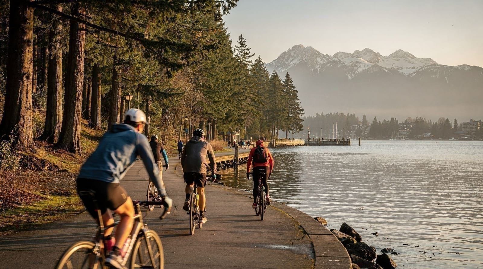
Pacific Spirit Park’s trail network includes a significant number of trails open to mountain biking, and cycling is a genuinely popular way to cover more ground than walking allows, particularly useful given the park’s scale. Not every trail permits bikes — some are designated pedestrian-only, particularly narrower or more ecologically sensitive sections like the Camosun Bog boardwalk — so checking trail signage or a current park map before setting out matters if cycling is your plan. For visitors without their own bike, rentals are available from several shops near the UBC campus and in Kitsilano, making a cycling visit a realistic option even without your own gear.
Which trailhead to start from
Given the decentralized layout, picking a starting trailhead matters more here than at a park with one obvious entrance. The Pacific Spirit Regional Park Nature House, near 16th Avenue and Blanca Street, functions as the closest thing to a main visitor hub — it has some interpretive information, restrooms, and a well-marked network of trails radiating outward, making it a sensible default starting point for a first-time visitor without a specific route in mind.
For a beach-focused visit, trailheads along the northern edge closer to Marine Drive connect more directly to the descents toward Spanish Banks and Wreck Beach, cutting down on how much flat forest walking you need to do before reaching the water. For a quieter, less-trafficked experience, trailheads on the park’s southern and eastern edges, further from both the beach descents and the Nature House, see noticeably less foot traffic even on busy weekends.
Weather and rain gear
Because the park is entirely at low elevation with no dramatic terrain to create localized weather effects the way the North Shore mountains sometimes do, Pacific Spirit Park’s conditions track fairly closely with general Vancouver-area forecasts.
That’s a mixed blessing: predictable, but also meaning the park sees the full brunt of the region’s roughly seven-month wet season (October through April), during which extended sections of the flatter trails turn genuinely muddy and slow to dry out, given the flat terrain doesn’t drain as quickly as the North Shore’s steeper canyon trails. A decent rain shell and waterproof footwear make a real difference here for anything beyond a short walk during the wetter months; summer visits are considerably more forgiving, with most trails dry and firm by June.
Sample routes for different time budgets
For visitors with only 45 minutes to an hour, the simplest plan starts at the Nature House near 16th Avenue and Blanca Street, walks one of the shorter interior loops through second-growth forest, and returns the same way — enough time to get a genuine feel for the trail surface, the tree canopy, and the general quiet without committing to a longer outing. This is a reasonable option for anyone staying nearby who wants a short walk between other plans rather than a dedicated activity in itself.
For a half-day of two to three hours, a beach-focused route works well: start from a trailhead nearer Marine Drive, walk through forest to one of the bluff-top viewpoints, descend to Spanish Banks, spend some time on the sand, and either retrace the same trail back up or arrange a pickup from a beach-adjacent road. This route gives the clearest sense of what makes Pacific Spirit Park distinct — forest giving way to a genuine waterfront, all within the city.
For a longer half-day or a full morning, combining the Camosun Bog boardwalk with a beach descent and a stop at the Nature House covers most of what the park offers in one outing, typically three to four hours including breaks. Cyclists covering the same ground on two wheels can realistically see considerably more of the 73 km network in the same window, since flat terrain and wide trails make for efficient riding compared to walking.
None of these routes require advance planning or a reservation — picking a trailhead that matches your starting point and available time, rather than trying to plan a precise route in advance from outside the park, is generally the more practical approach given how many junctions and options exist across the network.
What a first-time visitor notices
Visitors expecting something closer to Stanley Park’s polish sometimes find Pacific Spirit Park’s rougher, more utilitarian character a little disorienting at first — fewer interpretive signs, less manicured trail edges, and noticeably more mud and dog traffic than a curated visitor attraction. That’s not a flaw so much as an accurate reflection of what the park actually is: a working local green space rather than a tourist-facing sight.
Visitors who adjust their expectations accordingly tend to enjoy it considerably more than those arriving expecting a scaled-down version of Stanley Park’s seawall experience. The absence of crowds, in particular, tends to register quickly as a genuine relief for anyone who’s already spent a day or two navigating busier Vancouver attractions.
Practical notes
Cost: Free, no admission gate anywhere in the park.
Facilities: Minimal and scattered — a few trailheads have basic washrooms, but don’t count on finding one mid-trail. No food concessions within the park itself; UBC’s campus, a short walk or drive from several trailheads, has cafes and restaurants if needed.
Best time: Year-round, though the flat trails turn muddy for extended stretches from October through April after sustained rain. Summer offers the driest trails and easiest beach access; weekday visits are consistently quieter than weekends, when local dog walkers and families turn out in force.
Time needed: As little as 45 minutes for a short loop near a single trailhead, up to several hours if you’re combining forest trails with a beach descent and return climb. There’s no obligation to “complete” anything — most visitors pick a manageable loop rather than attempting the full 73 km network in one visit.
Navigation: Given how many trailheads and junctions exist across the network, downloading an offline trail map or using a GPS-based hiking app before setting out is genuinely useful here in a way it isn’t at smaller, single-loop parks. Physical trail maps are posted at some major junctions and available at the Nature House, but relying solely on posted signage for a longer route through the park’s interior is a common way for first-time visitors to end up somewhere unexpected, even though the risk is more about wasted time than any real safety concern in a park this close to the city.
Top experiences
Bookable activities with verified prices and instant confirmation on GetYourGuide.