Getting around Vancouver — transit, driving, and day-trip logistics
Vancouver: Hop-on Hop-off Tour by Double-Decker Bus
What's the best way to get around Vancouver?
TransLink's SkyTrain, SeaBus, and bus network covers most of the city and North Shore well, using a reloadable Compass Card with zone-based fares (one-zone CAD 2.85, two-zone CAD 4.20, three-zone CAD 5.40, 90-minute transfers included). A car is only worth renting for day trips to Whistler, Squamish, or the Fraser Valley — not for getting around the city itself.
Vancouver is one of the easier North American cities to navigate without a car, thanks to a compact downtown core, a genuinely useful SkyTrain network, and an unusual SeaBus crossing that turns a harbour ferry ride into part of the regular transit system. Getting around well mostly comes down to understanding TransLink’s zone-based fare system and knowing when a rental car actually adds value versus when it’s just an added expense and parking headache.
| Main tool | Compass Card (TransLink: SkyTrain, SeaBus, bus) |
| City fares | CAD 2.85-5.40 per trip by zone, 90-min transfer |
| Airport | Canada Line, ~CAD 10 incl. YVR AddFare, 23-25 min |
| Rent a car for | Whistler, Squamish, Fraser Valley day trips only |
| Rental cost | Around CAD 50-100/day economy, CAD 120-200 SUV |
TransLink and the Compass Card
TransLink runs Vancouver’s SkyTrain (an automated light rail network), SeaBus (passenger ferry across Burrard Inlet to the North Shore), and an extensive bus network, all under a single reloadable Compass Card. Fares are zone-based: a one-zone trip costs CAD 2.85, two-zone CAD 4.20, and three-zone CAD 5.40, with a 90-minute transfer window that covers unlimited transfers across SkyTrain, SeaBus, and bus within that time on a single fare.
Compass Cards cost a CAD 6 refundable deposit and are available at vending machines in every SkyTrain station, at Waterfront Station’s customer service counter, and at London Drugs locations citywide. Day passes are available for visitors planning multiple trips in a single day, and monthly passes make sense for longer stays. Contactless credit cards and phone payment work directly at faregates without needing a physical Compass Card at all, which is the simplest option for short visits.
SkyTrain: the backbone of the system
The Canada Line connects YVR Airport to downtown Vancouver in about 23-25 minutes, passing through Richmond en route, and is the fastest and most predictable way to reach the city from the airport — a fare of roughly CAD 10 total, combining the one-zone base fare with a YVR-specific AddFare that only applies to trips originating at the airport station. The Expo Line and Millennium Line cover the rest of the city’s SkyTrain network, connecting downtown to East Vancouver, Burnaby, and beyond, useful mainly for day-trip connections and exploring neighborhoods further from the core like Commercial Drive.
SeaBus: the North Shore connection
The SeaBus crosses Burrard Inlet between downtown’s Waterfront Station and Lonsdale Quay in North Vancouver in about 12 minutes, running on the same Compass Card fare system as the rest of transit. It’s the standard way to reach North Vancouver attractions like Capilano Suspension Bridge and Grouse Mountain without driving, typically combined with a connecting bus from Lonsdale Quay to reach either attraction’s specific location.
Buses and getting off the main lines
TransLink’s bus network fills in the gaps SkyTrain and SeaBus don’t cover, including routes to West Vancouver, Kitsilano, and other neighborhoods without direct rail access. Buses run on the same Compass Card fares and transfer rules as the rest of the system, though frequency drops outside peak hours, so checking real-time arrival apps before heading to a stop saves meaningful waiting time compared to just showing up and hoping.
Bus routes also tend to be the most weather-exposed part of the system, since waiting at a street-level stop offers less shelter than a SkyTrain station, which is worth factoring in during Vancouver’s wetter months when a five-minute wait can mean standing in real rain rather than a covered platform.
Walking and cycling downtown
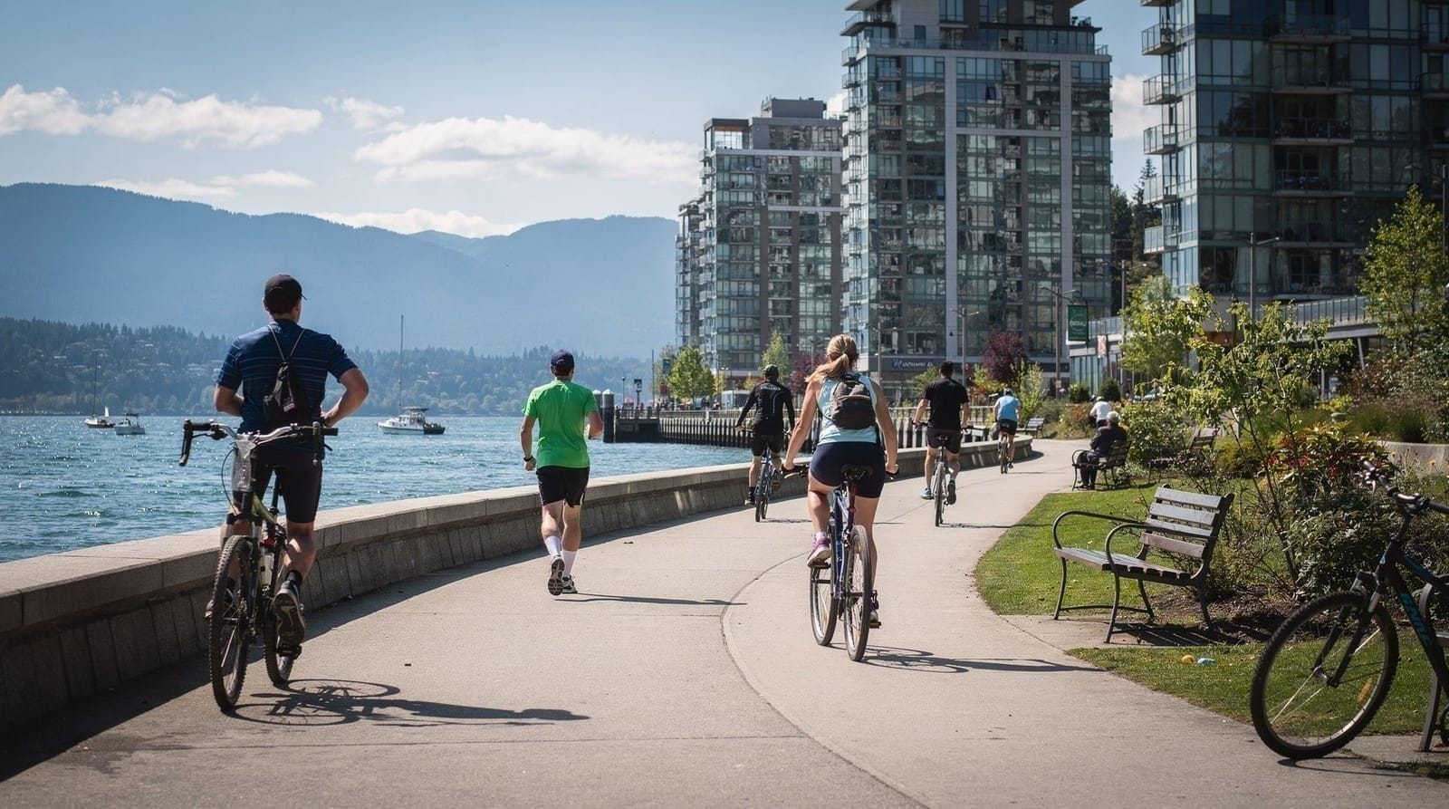
Downtown Vancouver, the West End, Yaletown, and Gastown are all genuinely walkable, compact enough that many visitors barely need transit within the core itself. The Stanley Park Seawall extends this on foot or by bike around the entire park perimeter, and Vancouver’s bike-share system and dedicated bike lanes make cycling a legitimate way to cover more ground than walking without needing a car — particularly appealing given how flat most of the downtown peninsula is compared to the hillier neighborhoods further out.
When a rental car makes sense
A car adds real value for exactly one category of trip: day trips beyond the transit network’s reach, specifically Whistler, Squamish, the Fraser Valley, and self-driven Sea-to-Sky Highway exploration.
Rental costs typically run CAD 50-100 per day for an economy vehicle and CAD 120-200 for an SUV, and driving is on the right-hand side, familiar to North American visitors and adjustable for most others within a day or two. Downtown parking costs CAD 3-6 per hour at most lots and meters, which adds up fast for a car that’s mostly sitting idle while its owner sightsees on foot — a strong argument for renting only for the specific days a car is actually needed rather than for the whole trip.
Getting to Whistler
Reaching Whistler without a car is straightforward: shuttle bus services run multiple daily departures from downtown Vancouver, taking roughly two to two and a half hours along the Sea-to-Sky Highway. A hop-on hop-off bus tour covers city sightseeing on a similar flexible-schedule model, useful for days spent in Vancouver itself between any Whistler or day-trip plans. For Whistler specifically, guided day tours add sightseeing stops at Shannon Falls or the Sea to Sky Gondola along the route, which self-driving or the plain shuttle bus don’t include.
Getting to Victoria and Vancouver Island
BC Ferries connects Tsawwassen, roughly 45 minutes south of downtown, to Swartz Bay near Victoria, with the crossing itself taking about 1 hour 35 minutes through the scenic Gulf Islands. Reaching the Tsawwassen terminal from downtown without a car requires a bus connection, which adds time versus driving directly, so many visitors either rent a car for the day or book a guided tour that includes transport to and from the terminal as part of the package. A floatplane transfer from the downtown harbour is the faster alternative, at a higher price, departing much closer to most hotels than the ferry terminal does.
Airport transfers
Beyond the Canada Line SkyTrain, taxis and rideshares from YVR to downtown run roughly CAD 35-55 and take 30-40 minutes depending on traffic, while hotel shuttles are common for guests at participating properties and worth booking ahead. For travelers who’d rather not manage luggage on transit, a private airport transfer handles the trip door to door without needing to navigate SkyTrain stations or find a taxi queue after a long flight.
Getting around with kids or mobility needs
TransLink’s system is broadly accessible, with elevators at SkyTrain stations and low-floor buses citywide, and HandyDART service available for specialized accessibility transport with advance booking. Families traveling with strollers generally find SkyTrain and SeaBus easier to manage than buses, which have more limited space, and the where to stay guide covers which neighborhoods minimize the amount of transit needed for family-friendly sightseeing.
Common transit mistakes
The most common mistake is assuming a car is necessary for the whole trip, when in practice most visitors are better served by transit for city days and a single rental or guided tour day for Whistler or Squamish specifically. The second is not accounting for the YVR AddFare when budgeting the airport SkyTrain trip, which catches some visitors off guard at roughly double what a normal one-zone fare would cost. The third is underestimating downtown parking costs and hassle for a trip that’s mostly on foot anyway — a car sitting in a CAD 40-a-day parking lot while its owner walks the Seawall is a common and avoidable expense.
Understanding the zone system
TransLink’s three-zone system is based on how many zone boundaries a trip crosses rather than distance traveled in a straight line, which can be counterintuitive for first-time visitors. A trip entirely within downtown or between adjacent central neighborhoods is typically one zone. Crossing into the North Shore via SeaBus, or out to Richmond, usually bumps into a second zone.
The airport’s YVR AddFare is a separate surcharge layered on top of the normal zone fare rather than a fourth zone, which is why airport trips cost noticeably more than a typical two-zone journey elsewhere in the system. It’s worth checking the specific zone map for planned day trips within the city, since guessing wrong on zone count is the most common way visitors either under-tap their fare or overpay by assuming a higher zone than necessary.
Cost comparison: transit versus car versus rideshare
For a typical multi-day visit focused on downtown, Stanley Park, and nearby neighborhoods, transit is by far the cheapest option — a day pass or a handful of Compass Card taps rarely exceeds CAD 15-20 per person per day, compared to CAD 50-100+ for a rental car once parking, fuel, and insurance are factored in, or CAD 15-25 per short rideshare trip if relying on Uber or Lyft for every movement around the city.
Rideshare makes sense for late-night trips when transit frequency drops, or for direct point-to-point journeys with luggage, but using it as the default for a multi-day trip adds up fast compared to a Compass Card or day pass. The math flips only once day trips outside the transit network enter the picture, where a shared rental car for a group can undercut the per-person cost of a guided tour, though it adds the driving effort and parking logistics that a tour avoids entirely.
Getting to Squamish and the Sea-to-Sky corridor
Squamish sits roughly an hour north of Vancouver along the same Sea-to-Sky Highway that continues on to Whistler, and it’s reachable by the same shuttle bus services that run the full Whistler route, with some options allowing a Squamish-only ticket for travelers not continuing further. Self-driving is straightforward on this stretch specifically, since it’s shorter and less demanding than the full Whistler drive, making it a reasonable first mountain road trip for visitors nervous about BC’s highway driving. Guided day tours combining Squamish’s Sea to Sky Gondola with a broader Whistler day are common and let visitors see both without managing two separate trips.
Cruise terminal and port transfers
Vancouver serves as a major Alaska cruise embarkation and disembarkation port, and Canada Place downtown handles the bulk of that traffic. Transfers between the cruise terminal and downtown hotels are typically a short taxi or rideshare ride, given how central Canada Place already sits, while transfers to and from YVR Airport on cruise turnaround days follow the same SkyTrain or taxi options covered above, just with the added logistics of luggage and, often, a specific ship-mandated departure window.
Cruise passengers on a short pre- or post-cruise stay should build extra buffer time into airport or port transfers on turnaround days specifically, since traffic and transit both run heavier than a normal day given the volume of passengers moving simultaneously.
Rideshare and taxi options
Uber and Lyft both operate throughout Vancouver and the surrounding region, alongside traditional metered taxis, which remain a reliable option particularly for airport pickups and late-night trips when rideshare surge pricing can climb. Rideshare pricing is generally comparable to or slightly below traditional taxis for most trips, though surge pricing during major events — Canada Day, big concerts, cruise turnaround days — can push costs up noticeably, worth checking before committing to a rideshare over transit or a booked transfer during those specific windows.
Journey planning apps
The TransLink website and app provide real-time arrival information and trip planning across the full SkyTrain, SeaBus, and bus network, and are worth downloading before arrival rather than relying purely on station signage. Google Maps also integrates TransLink data reasonably well for basic route planning, which most visitors find sufficient for day-to-day navigation without needing a dedicated app at all.
For day-trip planning beyond the transit network — checking road conditions on the Sea-to-Sky Highway or BC Ferries sailing schedules — the respective operators’ own sites and apps (DriveBC, BC Ferries) are more reliable than general mapping tools, since they reflect real-time closures and sailing waits that a standard map app won’t show.
Peak hours and when to avoid the busiest transit times
Weekday rush hours, roughly 7:30-9:30am and 4:30-6:30pm, see SkyTrain and SeaBus running at their most crowded, particularly on the Canada Line given its dual role serving both airport travelers and daily commuters. Visitors with flexible schedules can avoid the worst of this by shifting sightseeing departures slightly outside these windows, which also tends to mean shorter queues at popular attractions that see a wave of arrivals right as commuter traffic clears. Weekends run a different, generally lighter pattern, though special events and cruise turnaround days can create their own localized crowding independent of the usual weekday rush.
Accessibility in more detail
Beyond the elevators and low-floor buses already mentioned, TransLink publishes detailed accessibility information for every station and route, useful for travelers planning specific accessibility needs ahead of arrival rather than discovering gaps on the day. HandyDART, the specialized door-to-door service, requires advance registration and booking, which isn’t always practical for short-term visitors, making standard accessible transit (SkyTrain and buses) the more realistic option for most trips.
Hotels in downtown Vancouver and the West End tend to sit closest to the most accessible transit connections, which is worth factoring into the where to stay guide’s neighborhood comparisons for travelers with mobility considerations.
Putting it together
For most visitors, the right approach is Compass Card transit for every city day, walking for downtown neighborhoods, and either a single-day car rental or a guided tour for whichever day trips are on the itinerary. The first-time visitor guide and 3-day plan both build from this same transit-first logic, and the where to stay guide covers which neighborhoods minimize how much transit is needed in the first place by keeping most attractions within an easy walk.
Travelers can also mix approaches within a single trip — using transit for the bulk of a stay and adding a single rideshare or short rental only for a specific evening or day trip that genuinely benefits from it, rather than treating the choice as strictly all-transit or all-car for the entire visit.
Anyone still unsure whether to budget for a rental car should ask a simple question before booking: does the itinerary include Whistler, Squamish, or a self-driven day trip beyond the transit network’s reach? If yes, a single-day or two-day rental targeted specifically at those dates is the efficient choice; if the whole trip stays within the city and its immediate transit-connected neighborhoods, a Compass Card covers everything needed without the added cost and parking hassle of a car sitting idle for most of the stay.
Getting this one decision right — transit-first for the city, a car or tour only for the specific days that need it — does more to keep a Vancouver trip both affordable and low-stress than almost any other single planning choice covered across this site’s guides.
Ferries as transit, not just scenery
Beyond the SeaBus, Vancouver treats a couple of small passenger ferries as genuine transit rather than tourist novelties: the Aquabus and False Creek Ferries mini-boats connecting Yaletown, Granville Island, Science World and Kitsilano run on their own fare system (not Compass Card), typically a few dollars per crossing. They’re worth knowing about even for visitors not planning a dedicated Granville Island trip, since they’re often the fastest way to cross False Creek without a long walk around.
Frequently asked questions — Getting around Vancouver
How do I pay for transit in Vancouver?
The Compass Card is TransLink's reloadable fare card, available for a CAD 6 deposit at vending machines in every SkyTrain station, at Waterfront Station, and at London Drugs stores citywide. It works across SkyTrain, SeaBus, and buses, with a 90-minute transfer window covering all three modes on a single fare. Tap-to-pay with a contactless credit card or phone is also accepted directly at faregates and bus readers without needing a physical Compass Card.How much does the SkyTrain cost from the airport to downtown?
The Canada Line SkyTrain from YVR to downtown takes about 23-25 minutes and costs roughly CAD 10 total — a one-zone fare (CAD 2.85) plus a YVR AddFare (CAD 6.50) that applies only to trips starting at the airport station. It's the fastest and most predictable way to reach downtown, especially during rush hour when road traffic slows taxis and rideshares significantly.Do I need a car to visit Vancouver?
No, not for the city itself — TransLink's transit network, combined with walking, covers downtown, Stanley Park, Granville Island, and most neighborhoods well. A car becomes genuinely useful only for day trips to Whistler, Squamish, the Fraser Valley, or other destinations outside the transit network's reach, and even those are well served by guided tours for travelers who'd rather not drive.How do I get from Vancouver to Whistler without a car?
Shuttle bus services run multiple daily departures between downtown Vancouver and Whistler Village, taking roughly two to two and a half hours along the Sea-to-Sky Highway. Guided day tours cover the same route with sightseeing stops built in at Shannon Falls or the Sea to Sky Gondola, and are a popular choice for visitors who want the scenery without renting a car or driving mountain roads themselves.Is parking expensive in downtown Vancouver?
Yes, relative to many North American cities — downtown street and lot parking commonly runs CAD 3-6 per hour, with daily rates climbing well beyond that near major attractions and during peak season. Combined with the effort of navigating one-way streets and limited street parking, this is one of the main reasons transit or walking works better than driving for anyone based downtown.What's the fastest way to get to Victoria from Vancouver?
BC Ferries from Tsawwassen (south of Vancouver) to Swartz Bay (near Victoria) takes about 1 hour 35 minutes and is the standard route, reachable from downtown by a roughly 45-minute drive or bus connection to the terminal. A floatplane or seaplane transfer is faster door-to-door, typically 35-45 minutes total flight time, at a higher price point, and departs from the downtown harbour rather than requiring the drive to Tsawwassen.
Top experiences
Bookable activities with verified prices and instant confirmation on GetYourGuide.