Driving the Sea-to-Sky Highway — a practical guide
Squamish: Sea to Sky Gondola Admission Ticket
- Free cancellation
How long does it take to drive the Sea-to-Sky Highway from Vancouver?
Vancouver to Squamish takes about 45 minutes to an hour under normal conditions, and continuing to Whistler adds roughly another hour, for a total of about 1 hour 45 minutes to 2 hours door to door. Weekend traffic, ski season conditions, and stopping at viewpoints along the way all extend that considerably.
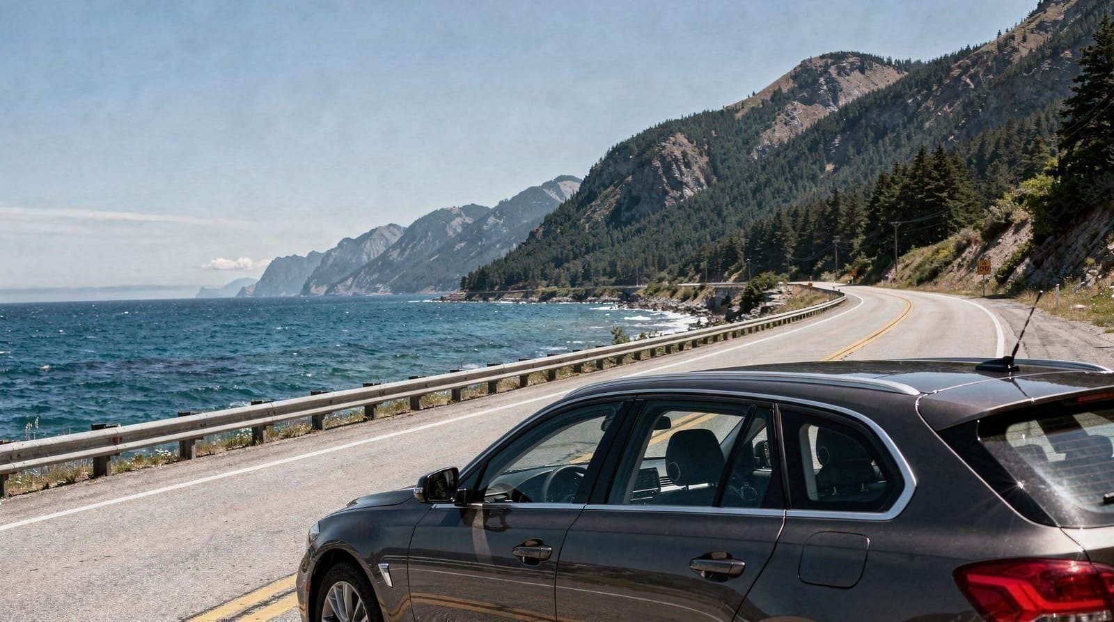
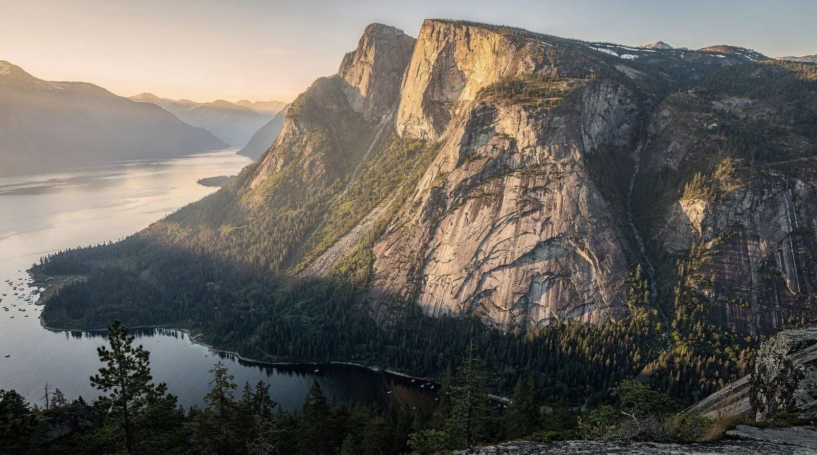
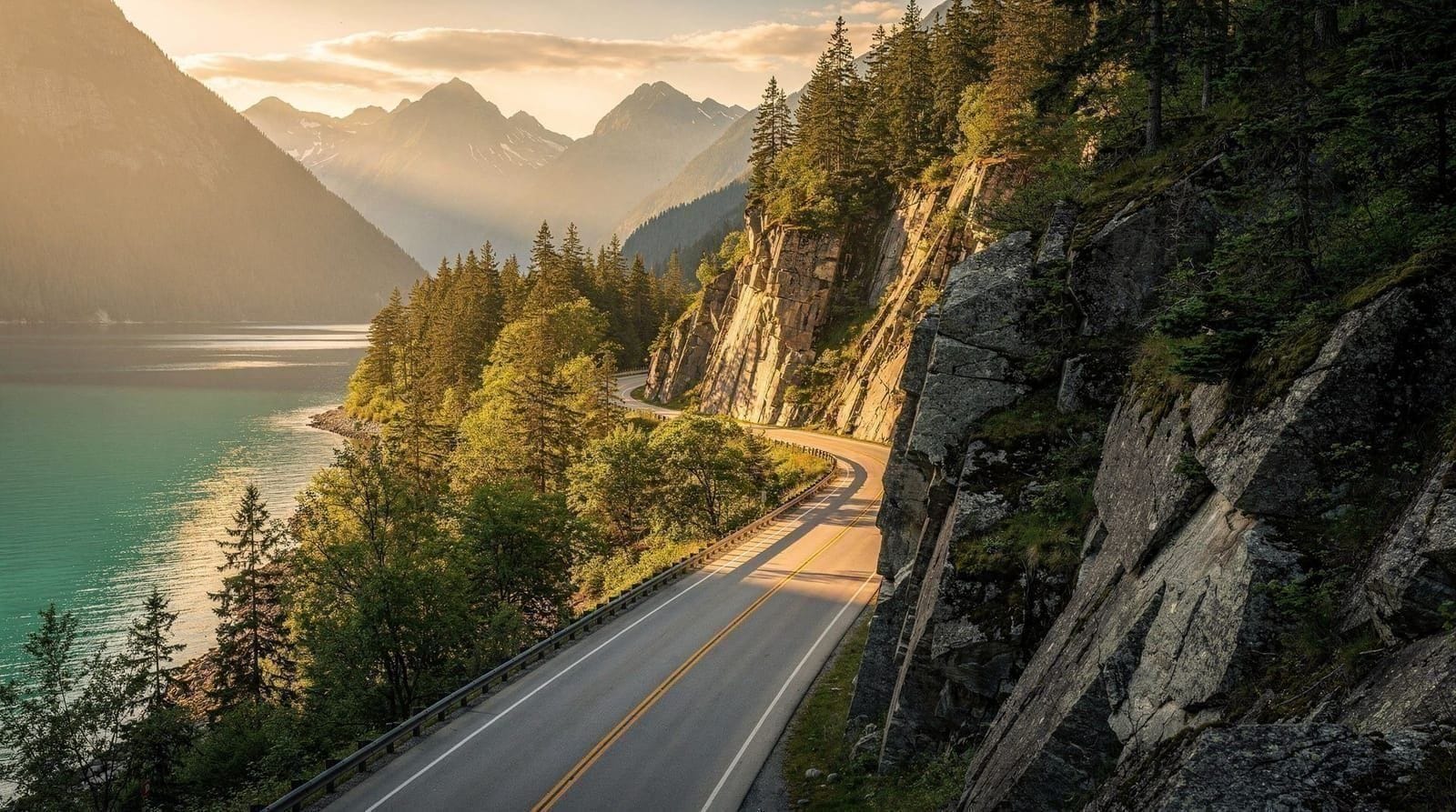
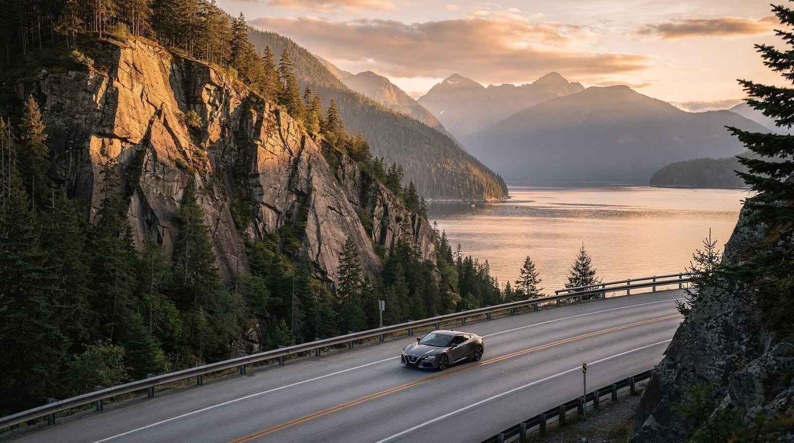
Highway 99 north from Vancouver to Whistler is consistently ranked among Canada’s most scenic drives, and unlike a lot of “scenic highway” claims, this one holds up — the road runs directly along Howe Sound with mountains rising straight from the water before climbing into alpine terrain, and the drive itself is arguably as much a highlight of a Whistler trip as the destination. Whether it’s approached as a fast transfer or a slow, stop-filled day out, understanding the route, the timing, and the seasonal quirks in advance makes a real difference to how the drive actually feels behind the wheel.
| Drive time | Vancouver–Squamish 45min-1hr; Squamish–Whistler 50-60min |
| Best stops | Shannon Falls, Sea to Sky Gondola, Stawamus Chief, Brandywine Falls |
| Winter tires | Legally required Oct 1–Apr 30 |
| Best time | May–September for easiest conditions |
| Fuel/food | Squamish is the reliable midpoint |
| Self-drive vs tour | Self-drive for flexibility; tour for no-car or winter comfort |
The route in overview
Unlike downtown sightseeing, which is well covered by TransLink, this corridor sits entirely outside the transit network, making a car — rented at YVR or downtown — the default way to see it.
The Sea-to-Sky Highway starts at the northern edge of Metro Vancouver, in West Vancouver, and runs north along the eastern shore of Howe Sound through Squamish before climbing into the Coast Mountains toward Whistler. The name reflects the terrain: it genuinely runs from sea level at Horseshoe Bay to alpine elevation at Whistler, a transition that’s visible in real time through the windshield rather than just a marketing name.
Drive times, realistically
Vancouver to Squamish takes about 45 minutes to an hour in normal traffic, covering roughly 65 kilometres. Continuing from Squamish to Whistler adds a further 50-60 minutes, covering another 60 kilometres of more mountainous terrain. Door to door, Vancouver to Whistler without stops runs about 1 hour 45 minutes to 2 hours. These are drive times only — anyone planning to stop at Shannon Falls, the Sea to Sky Gondola, or other viewpoints along the way should budget significantly more, easily turning the drive itself into a half-day outing rather than a quick transfer.
Weekend and seasonal traffic
Friday afternoons and Sunday evenings see the heaviest traffic on this route, as Whistler-bound weekend visitors and returning day-trippers create predictable congestion, particularly through Squamish and on the approach to Whistler Village. Winter weekends during peak ski season (December through March) compound this further. Traveling on a weekday, or timing weekend trips to avoid the worst of the Friday afternoon and Sunday evening windows, meaningfully improves the drive.
Shannon Falls
About 45 minutes north of Vancouver, just past Squamish’s town center, Shannon Falls is British Columbia’s third-highest waterfall and one of the easiest major stops on the route — a five-to-ten-minute walk from the parking lot to a solid viewing platform, with no significant elevation gain. It’s especially impressive in late spring and early summer when snowmelt feeds the flow at its highest volume, and remains worth the stop even in drier late-summer months when the flow is reduced but still visible.
The Sea to Sky Gondola
Almost directly across the highway from Shannon Falls, the Sea to Sky Gondola climbs from near sea level to 885 metres on Mount Habrich, opening up sweeping views over Howe Sound, the Stawamus Chief, and the surrounding Coast Mountains.
A Sea to Sky Gondola admission ticket booked in advance is worth arranging before the drive, since it’s one of the most popular stops on the entire corridor and lines build through midday, particularly on clear-weather weekends. Budgeting at least 90 minutes to two hours for the gondola stop, including the ride up, time at the summit viewpoints and suspension bridge, and the ride back down, is realistic for most visitors.
Stawamus Chief
The granite monolith looming over Squamish, known locally as the Chief, is one of the most recognizable landmarks on the route and a world-renowned rock climbing destination with hundreds of established routes, some covered in the via ferrata Squamish guide for visitors wanting a guided ascent rather than technical climbing. Non-climbers can still appreciate it from a roadside pullout viewpoint without hiking, though the summit trail (a genuinely strenuous hike, not a casual stop) is a serious undertaking for visitors specifically planning a hiking day, covered among other regional trails in the best hikes in Vancouver guide, rather than a highway drive with brief stops.
Britannia Beach
A short detour just north of Horseshoe Bay, Britannia Beach is home to a former copper mine turned into a mining museum, offering an easier, more low-key stop than the Chief or the gondola — a reasonable choice for a shorter break, especially for families or visitors who’ve already done a more strenuous stop earlier in the drive and want something less physically demanding.
Brandywine Falls
Closer to Whistler than to Squamish, Brandywine Falls drops about 70 metres from a roadside parking area reached by a short, flat walk, making it one of the easiest high-payoff stops on the entire corridor. It’s a good final stop before arriving in Whistler, particularly for anyone who’s already done the more strenuous Chief or gondola stop earlier and wants a low-effort finish to the drive.
A highway rebuilt for the Olympics
Much of the modern Sea-to-Sky Highway’s quality — wide shoulders, improved sightlines, dedicated turning lanes at major stops — dates to a major upgrade completed ahead of the 2010 Winter Olympics, when Whistler hosted alpine events and the route needed to reliably move large volumes of traffic and athletes on a tight schedule. The pre-upgrade highway had a reputation as a narrower, more dangerous road; the post-2010 version is a considerably safer and more comfortable drive, which is worth knowing for anyone who’s read older, more cautionary accounts of the route online and is expecting a rougher road than what actually exists today.
Wildlife along the route
Black bears are occasionally visible from the highway itself, particularly in spring and early summer when they forage along roadside vegetation near Squamish and the approach to Whistler — always view from inside a vehicle rather than stopping to approach, both for safety and because roadside bear-watching contributes to bears becoming habituated to traffic, which is genuinely bad for the animals long-term. Bald eagles are a more common and less risky sighting, especially along the Squamish estuary in late fall and winter, when the Squamish area hosts one of the larger seasonal eagle gathering sites in North America, drawn by salmon runs in the Squamish and Cheakamus rivers.
Photography pullouts worth knowing
Beyond the named stops like Shannon Falls and the gondola, several unmarked or lightly marked roadside pullouts along the Howe Sound stretch offer strong photo opportunities of the water and surrounding peaks, particularly in the first 30 minutes north of Horseshoe Bay. These aren’t destinations in themselves, but a driver with a passenger free to watch for pullout signs can grab a few extra photo stops without significantly extending the overall drive time, since most are a two-minute stop rather than a full detour.
EV charging along the corridor
Electric vehicle charging infrastructure along Highway 99 has expanded substantially in recent years, with fast chargers available in Squamish and in Whistler Village, making an EV rental a workable option for this specific route even though it requires more planning than a gas vehicle. Checking current charger locations and availability before departure is worth doing, particularly during busy weekends when charger demand spikes alongside traffic.
What to pack for the drive
A phone charger or car adapter, given how much battery navigation and photography both consume over a multi-hour outing. Layers, since temperature and weather shift meaningfully with elevation — a mild, even warm day in Vancouver can be notably cooler and windier at the Sea to Sky Gondola summit or in Whistler Village. Snacks and water, particularly for a self-driven trip with flexible stops, since not every viewpoint has food available. And in winter, an emergency kit (blanket, extra layers, a flashlight) is a sensible precaution any time driving a mountain highway, even a well-maintained one like this.
Common mistakes on this drive
Underestimating how much time the stops add is the most frequent planning error — treating the trip as a straight 1 hour 45 minute transfer and then being surprised when Shannon Falls, the gondola, and lunch in Squamish push the day well past four or five hours. Skipping a check of DriveBC before a winter departure is another, particularly for visitors from climates without serious winter driving experience who don’t think to check road conditions the way a BC local automatically would. And assuming Whistler Village has the only food and fuel options worth using, rather than stopping in Squamish partway through, occasionally leaves visitors driving further than necessary on a low tank or an empty stomach.
Winter driving conditions
British Columbia legally requires winter tires or chains on designated mountain routes, including Highway 99 through the Sea-to-Sky corridor, between October 1 and April 30 each year. Snow and ice are realistic possibilities on the upper sections of the highway throughout this window, even when conditions in Vancouver itself are mild rain rather than snow — elevation changes the weather considerably along the route.
Checking DriveBC’s real-time road conditions before departure during winter months is a genuinely useful habit, since conditions can shift within hours during an active storm. Visitors unfamiliar with winter mountain driving, or without a vehicle properly equipped, are better served by a guided tour than a self-driven winter trip on this route.
Summer driving conditions
From roughly May through September, the highway is generally dry and straightforward, with the main challenges being weekend traffic volume rather than road surface conditions. Occasional wildfire smoke in late summer (typically August, depending on the fire season) can reduce visibility and air quality along the corridor, worth checking regional air quality advisories for during that period.
Self-driving versus a guided tour
Self-driving gives full control over pacing — stopping at Shannon Falls for ten minutes or an hour, skipping the gondola if time is tight, or adding an unplanned stop at a roadside viewpoint that catches your eye. It requires a rental car and comfort with mountain highway driving, more of a consideration in winter than summer.
A guided full-day Whistler tour removes all of that — a driver handles the route, stops are built into a fixed itinerary, and there’s no need to think about winter tires, parking, or navigation. For visitors without a car, uncomfortable with mountain driving, or simply wanting to enjoy the scenery without watching the road, a guided tour is the more relaxed option, and it often includes commentary on the landmarks passed along the way that a self-guided drive would miss.
Comparing this drive to other North American mountain routes
Visitors who’ve driven California’s Highway 1, Colorado’s mountain passes, or the Icefields Parkway in Alberta will find the Sea-to-Sky Highway shorter and, in good weather, considerably less technical than any of those — the total drive to Whistler is under two hours rather than a full day, and the road surface and grades are more forgiving than a high-altitude mountain pass. What it shares with those routes is the payoff-per-minute of driving: relatively little time behind the wheel delivers a genuinely dramatic shift in scenery, from coastal water views to alpine forest, which is part of why the corridor punches above its modest length in terms of reputation.
Fuel, food, and rest stops
Squamish is the natural midpoint for fuel and food, with a range of gas stations, cafes, and restaurants clustered near the highway. North of Squamish toward Whistler, options thin out considerably until reaching Whistler Village itself, so filling up and grabbing food in Squamish before continuing is the sensible move rather than assuming another town center will appear along the way.
Rest areas and washroom stops
Designated rest areas and washroom facilities exist at several points along the corridor, including at Shannon Falls, the Sea to Sky Gondola base, and Whistler Village itself, so a self-driven trip rarely requires an unplanned roadside stop for basic needs. Britannia Beach and Squamish’s town center both have public washrooms as well, making the route reasonably comfortable for families or anyone traveling with young children who need more frequent stops than a typical adult itinerary would plan for.
Cell coverage and navigation
Cell coverage is generally reliable along the full length of the corridor, including data for navigation apps, though it can weaken briefly in some of the more mountainous stretches between Squamish and Whistler. Downloading offline maps as a backup before departure is a reasonable precaution, particularly in winter when road closures or diversions are more likely and having an offline reference reduces reliance on a live signal.
Extending the drive: a full Sea-to-Sky day or road trip
For visitors with more than a single day, the corridor supports a proper multi-day road trip rather than just a one-way transfer to Whistler — stopping overnight in Squamish, spending a full day at the gondola and hiking trails, then continuing to Whistler for skiing or summer activities before returning. The Sea-to-Sky road trip itinerary lays out a three-day version of this route in detail, useful for travelers wanting to treat the corridor as a destination in its own right rather than a highway to drive through on the way to somewhere else.
Driving with kids
The Shannon Falls and Brandywine Falls stops are both short, flat walks well suited to young children, making them natural break points on a family drive where a car-bound kid needs to run around for ten minutes before the next stretch of driving. The Sea to Sky Gondola summit area has boardwalk paths and a suspension bridge that most kids find genuinely exciting rather than just another viewpoint, though the ride up itself (an enclosed gondola cabin) is worth mentioning to any child anxious about heights in advance. Britannia Beach’s mining museum, with underground tour components, is a reliable option for a rainy-day stop that doesn’t depend on clear weather the way the outdoor viewpoints do.
Continuing past Whistler
For travelers extending beyond a Whistler day trip — perhaps following the Vancouver and Whistler 5-day itinerary or comparing summer activities in the Whistler summer guide — Highway 99 continues north past Whistler Village into the Pemberton Valley, a quieter, more agricultural stretch with its own scenery — farmland framed by mountains rather than the coastal drama of the Howe Sound section.
This is a detour for a specific interest (visiting Pemberton’s farm stands, or continuing on toward Lillooet and BC’s interior) rather than part of a standard Vancouver-Whistler day trip, but worth knowing about for anyone with extra days and a rental car who wants to see more of the corridor beyond the Whistler turnoff.
A final practical note on timing the return
The drive back to Vancouver in late afternoon or evening deserves the same planning as the outbound leg — Sunday evenings in particular see the heaviest southbound traffic of the week as weekend visitors return from Whistler, and building in extra time for the return, or timing departure from Whistler before the worst of that window, avoids ending a good day with a frustrating crawl back into the city.
Motorcycle and cyclist notes
Highway 99 is also a popular motorcycle route in the drier months, given its combination of sweeping curves and consistently dramatic scenery, though the same winter tire restrictions that apply to cars keep most riders off the road entirely between October and April. Cyclists occasionally ride sections of the corridor, particularly around Squamish’s more level stretches, but the highway itself has narrow or absent shoulders in places and heavy vehicle traffic on weekends, making it a route for experienced road cyclists rather than a casual ride — dedicated cycling infrastructure within Squamish and Whistler themselves is a safer bet for a shorter, less exposed ride.
Radio, phone signal, and staying entertained on the drive
Cell coverage is generally reliable for calls and data along the corridor, as noted above, and most Vancouver radio stations fade out gradually past Squamish, replaced by more local or patchy reception heading toward Whistler — worth having a downloaded playlist or podcast ready rather than relying on live radio for the full drive. Passengers who enjoy narration can also look at the guided tour option, which typically includes commentary on the landmarks passed, something a self-driven trip misses unless a passenger has done the reading in advance.
The bottom line
Frequently asked questions — Driving the Sea-to-Sky Highway
Is the Sea-to-Sky Highway a difficult drive?
It's a genuine mountain highway with curves and elevation changes, but it's well-maintained, well-signed, and manageable for most drivers in good weather. Winter driving (November-April) requires more caution, and BC law requires winter tires or chains on this route during those months.What are the best stops between Vancouver and Whistler?
Shannon Falls (BC's third-highest waterfall, a short easy walk from the parking lot), the Sea to Sky Gondola in Squamish, the Stawamus Chief viewpoint, and Brandywine Falls closer to Whistler are the most rewarding stops. Britannia Beach's mining museum is a good option for a shorter, less strenuous break.Do I need winter tires to drive to Whistler?
Yes, if driving between October 1 and April 30. British Columbia legally requires winter tires or chains on designated routes including Highway 99 through the Sea-to-Sky corridor during these months, and most rental cars in Vancouver are equipped accordingly during that window.Should I drive myself or book a guided tour to Whistler?
Self-driving gives full control over timing and stops, which suits travelers wanting to explore Squamish's viewpoints at their own pace. A guided tour removes the need to navigate mountain roads and handles all the logistics, which suits travelers less comfortable with unfamiliar winter or mountain driving, or those without a rental car.Is the drive to Whistler scenic?
Genuinely, yes — it's regularly ranked among the more scenic drives in Canada, running along Howe Sound with mountains rising directly from the water for the first half, then climbing into forested mountain terrain for the second half toward Whistler.Where's the best place to fuel up and eat along the way?
Squamish is the natural midpoint, with a range of gas stations, cafes and restaurants clustered near the highway. Options thin out considerably between Squamish and Whistler Village, so filling up and eating in Squamish is the sensible move rather than counting on another town appearing along the route.Is there EV charging along the route?
Yes, fast chargers are available in both Squamish and Whistler Village, and infrastructure along Highway 99 has expanded substantially in recent years, though checking current charger locations and availability before departure is still worth doing on busy weekends.
Top experiences
Bookable activities with verified prices and instant confirmation on GetYourGuide.